Not just an idea...a life changing experience.

Freedom Thirty Five is all about experiencing life, not waiting until I'm 65 to retire. I want to see things I have never seen, meet new people, take on new challenges, make new friends and reconnect with old ones.


Sunday, July 31, 2011

Day 157-158 Waterton Lakes National Park, Canada – July 28-29th, 2011

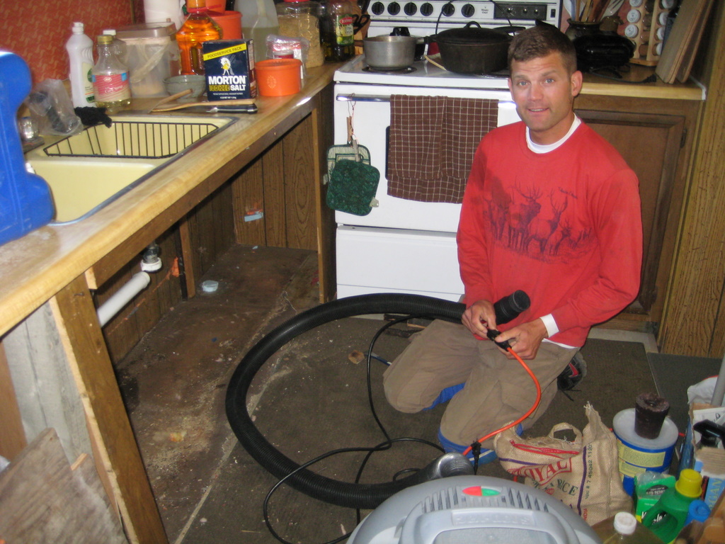
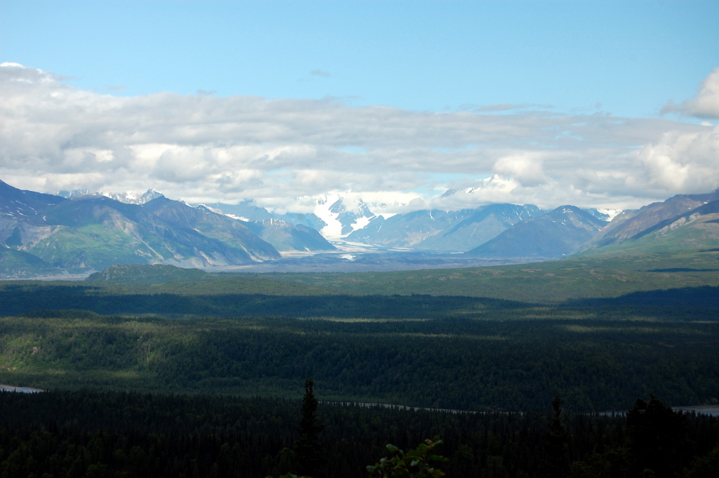
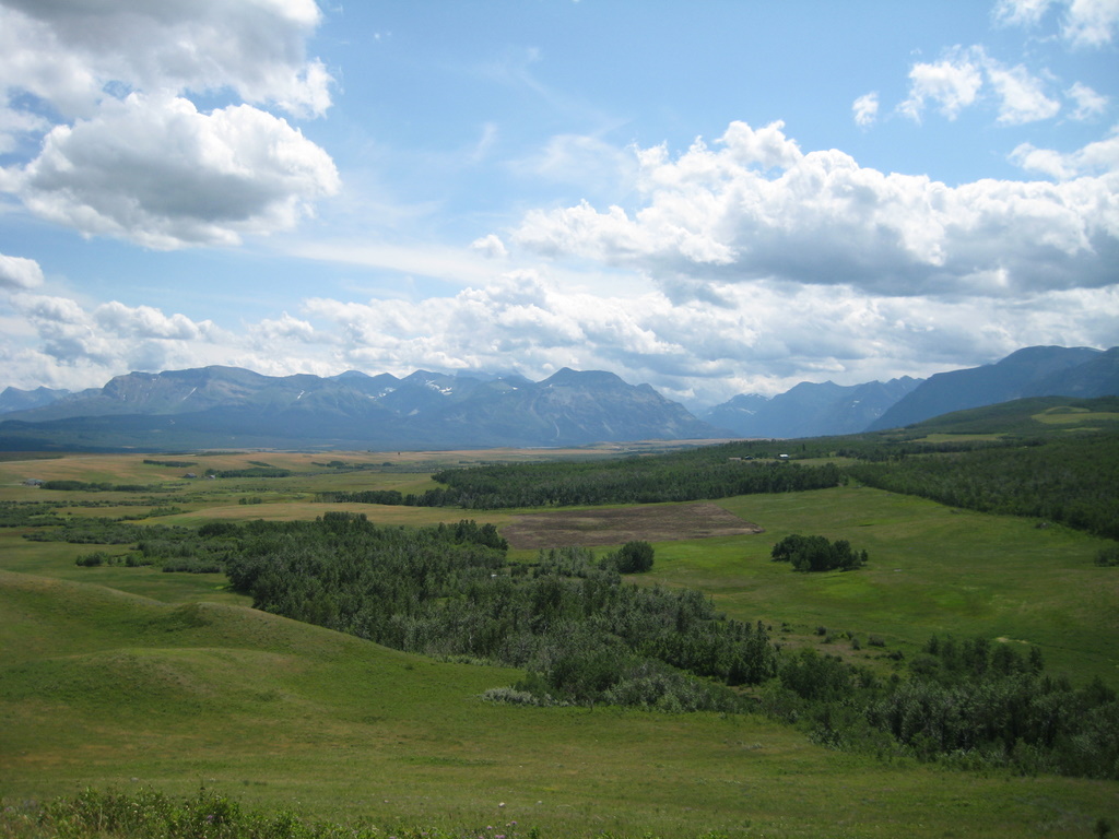
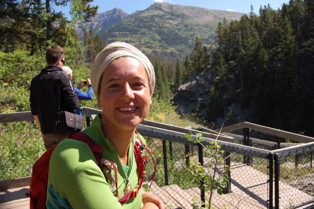
I arrived in Waterton in the midafternoon and managed to snag one of the last campsites avaible in the townsite, the other campgrounds were more remote.  The campsite was part of the walk-in section and was really tight quarters, more like a refugee camp, however it was walking distance to the town, lake and some good trails and there were free showers always a plus I m y books.  I setup camp and then went into town to the local internet cafĂ© for a bit of blogging, and trip planning.  The town itself is like nothing I have seen in a National Park, it had houses, post office, playground lots of restaurants and lodges, even a hostel but was very nicely laid out and did not feel overly touristy.  Afterwards I went for a run and really got to appreciate the beauty of the park.  This is truly one of the most beautiful places I have been.  One of the main reasons is that in this park the plains are abruptly met by the Canadian Rockies.  So you have these grassy plains, dotted with wildflowers, beautiful lakes, and Rocky Mountains in all directions.  Really amazing, I got some great photos, but it has to be seen first-hand.  Back at camp while making dinner I met Anker and his son Adam from Vancouver.  Adam was on summer break from Queen’s university in Kingston Ontario and he and his father were on a 2 week motorcycle trip around BC, Alberta, Montana and Washington.  They were taking mostly dirt roads when they could, and carrying all there camping gear on their bikes.  They were telling me about some of their previous trips, one they even drove all the way down the Baha peninsula  Anker was getting ready to retire and was truly interested in finding out more about my trip, so the 3 of us walked into town for a beer.  It’s always nice to meet good people while traveling, and that is definitely one of the advantages to travelling alone.  You are usually more approachable, and I find it easier to strike up conversations with random strangers.
The next day, I woke up early and hiked up to Bertha Lake, it’s a very popular hike, but I was the first one up there that morning, so it was really peaceful.  It’s about 4 mile hike up to the lake, and you pass a few huge waterfalls along the way, but that was not my final goal.  I wanted to scramble up to the top of Bertha Peak, that sat behind the lake.  The peak sits at just under 8000ft.  At the end of the trail I had to bush wack for a few hundred feet to get to the steeper less vegetated part of the slope, I was then able to follow a dry creek bed / waterfall most of the way up.  The rocks were typical of the Canadian Rockies and were very crumbly and kept breaking away in my hands, it makes the climbing a bit unnerving but most of the time I was not exposed very much.  Eventually I reached the ridgeline and then had to walk about ½ mile uphill to the summit.  Waterton is known for the strong winds that often blow through the area.  Most of the way up I was experiencing these winds, although it the weather was clear and warm, the wind kept on blowing.  Then when I reached the summit the wind calmed down and I was able to sit and enjoy my lunch and the view of the surrounding peaks, the townsite below and the lakes surrounding them.  It was great, I made my way back down to camp, and then relaxed for most of the afternoon.
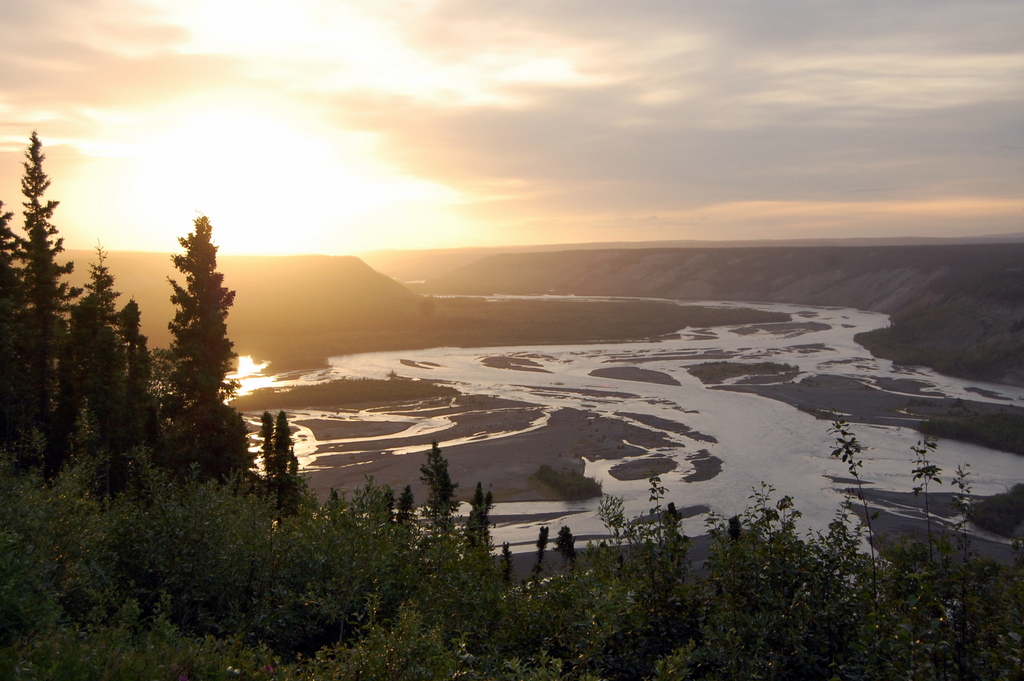
The next day after breakfast and a quick stop at the Prince of Wales Hotel, which is the old fancy chalet building on a hill overlooking town I headed out on my way to Montana and Glacier National Park.  ON the way I picked up a hitchhiker.  She was a woman from France, maybe in her early 30’s, she was heading to another part of Waterton for a short hike and then hitching to Calgary.  I decided to join her for her hike and then agreed to give her  ride to the highway where we would part ways.  I found out that she has been travelling around North America for 5 months alone, and hitching the entire time.  She usually bandit camps (meaning she camps in the woods and does not pay for campsites).  She often ends up travelling with people that have picked her up.  She had been through California, Arizona, New Mexico, down to Florida, then up the east coast and eventually to Montreal and then across Canada to where I met her.  She was on her way  to Alaska and then flying back to France.  I inquired as to what she did for work, she explained that she was a teacher, but not a school teacher.  She taught people to dance, mime, and be a clown!  She really was a free spirit and one of the more interesting people I have met on my trip.  I know some of you think it’s cazy to pick up hitch hikers, but I have had to do it my self on this trip, so I decided then that I would pick up any hitch hikers that I passed, that did not look like they were going to kill me.  I’ve picked up at least 4 total on this trip, most for only short rides.  This was my first time picking up a woman though, and definitely the most interesting.  We parted ways and I headed south to Montana and Glacier National Park.

Photo Album:  FTF Day 156-157

Wednesday, July 27, 2011

Day 154-156 Banff National Park – July 25-27th, 2011

I spent my first night in the Rockies just inside Banff National park at the Rampart Creek wilderness hostel.  The hostel has basic electricity and no plumbing, so it’s primitive, but the beds are comfortable and the price is the same as a campsite for 1 night.  Since I’m travelling solo hostels just make more sense.  There were a couple groups there and we had a campfire, but it was a relatively quiet night.
The next morning I got up early and headed down the parkway to Sarbach Mountain.  I started out on a well worn trail hiking 5.2 km (3.1 miles) to a lookout at the base of the mountain.  From there I headed through the woods above the tree line and continued to the ridge of the mountain.  I then followed the ridge line all the way up.  I had the pass through a couple slots that required some down climbing and then climbing back up the far side.  After a few hours, was up to the last part of the hike, I had to scramble up a steep ridgeline, there were also a few pitches I had to climb up.  I made all the way to the false summit and decided to stop there.  I made it to the summit if 4 hrs.  My guide book warned the true summit was very steep and few people climbed it.  I could also see that it was completely snow covered, and not looking very safe, so I opted not to go for it since I was alone.  The weather had been off and on with a bit of rain here and there and then the sun would break through periodically as well.  Luckily the sun came out while I was on the summit so I enjoyed lunch up there.  After a 20 minute break I made my way back down.  On the way down I decided to scramble further down the north slope of the mountain to avoid some of the down climbing on the ridgeline.  This worked out until I had to cross a snowfield.  I checked the snow and it was pretty soft so I decided I did not need crampons on an ice axe (both of which were attached to my pack), while making my way across I started to slied down and got out of control, luckily the snowfield was relatively short and I slid and hit some rocks pretty hard and grabbed them before slipping off the down a small cliff.  It would not have been a fatal fall but would have really hurt.  I’ve learned my lesson next time the axe comes out.  The rest of the trip back down was relatively uneventful, with the exception of about 20 mins of hail that fell on me.  Of course by the time I was back o trail in the woods the sun was shinning and it warmed up.
I made my way to the hostel in Lake Louise, but they were full so I headed down to Banff and snagged a room there.  The hostel was very busy, lots of tour groups and other travelers, but I managed to get some blogging caught up, planning  for my trip, and laundry done.
Next I headed down to Waterton Lakes National Park in southern Alberta.

Day 153 – Prince George, British Columbia – July 24th, 2011

After previous day driving for so long, I was relieved to only have to drive 454 km to Prince George (PG).  I arrived around 12:30Pm and met with couchsurfing hostess Quinn.  She was originally from Calgary Alberta, and had moved to PG about won year ago to pursue a graduate degree.  I set off on a run through the woods near the university.  When I returned she took me on the grand tour of PG, including the PG man, the collection of art bears scattered around town and a few different murals.  The town itself was very dead for a Sunday afternoon.  That night we headed out to a local pub for a dinner.  I headed out of town early the next morning headed for the Rockies.

Day 152 – Whitehorse to Lake Seely Provincial Park – July 23rd, 2011

Drove for 12.5 hrs with very few stops, covered  727 miles (1170km) including the Cassiars highway in its entirety.  Bandit camped at Lake Seely Provincial Park.

Day 151 – Whitehorse, Yukon Territory – July 22nd, 2011

Drove from Dawson City to Whitehorse, and then met with my hosts Daniel and Megan they took me into town for Sushi.  Since they were heading to bed early I went out with a couple other couch surfers Ash from Australia and his hostess Melinda.  The bars in Whitehorse do not have A/C, since it was hot that day the bar was crazy!

Day 150 – Dawson City, Yukon Territory – July 21st, 2011

I arrived in Dawson City and contacted my couch surfing host Mark. He asked me if I played soccer and I said “a bit” he said “good enough” and explained to me where to find him. I went down to the park and joined a pickup game of soccer, it’s been about 6 months since I have played, but it was good fun after spending most of the day in the car driving. Afterwards we headed downtown so mark could show me around town. That’s when he insisted I try the sourtoe cocktail. Check out the photos for more on this! After some pool, karaoke we headed back to the camper in the RV park where he is staying for the summer. I’ve couch surfed in a ll kinds of places, it’s been very cool no matter where it is. The next day I woke up and headed out for a run, the first in a couple week. After a quick shower I headed out destined for Whitehorse.

Album:  FTF Day 150

Day 147-149 – Delta Junction, AK – July 18th-20th

After leaving Anchorage I was ready for some downtime.  Lara had contacted me and invited me to come to her place in Delta Junction.  It was on my way back to Canada and it would give me a chance to catch up on some blogging and other admin work.  Lara live in a dry Cabin, she got the place dirt cheap and has been working on it for a couple years, so I volunteered to help her out.  I helped out my replacing the subfloor under the sink which was rotted out.  That evening we met with a couple of her friends, and then decided to have a bonfire at Lara’s, she has lots and lots of scrap wood, and logs in her 5 acre yard to burn, so it was quite the fire.  I really enjoyed just relaxing and doing some useful handy-work, sometimes you miss the “normal” life.

Day 137-146 – Katmai National Park – July 8th-17th, 2011

Edra dropped off Sarah and I at the Anchorage airport we caught our plane to King salmon, ironically enough the plane was a 737 that is painted like a King Salmon, one of the few in Alaska Airlines fleet.  George met us at the airport in King Salmon and we were not scheduled to fly to Brooks Camp until the next day, we dropped our bags off at George’s hotel and started our own little pub crawl of King Salmon.  After experiencing all King Salmon had to offer, we hitched a ride to Naknek.  We were picked up by 2 guys that were there working in the fishing industry (just about everyone does) and they proceeded to give us a driving tour of Naknek, and even offered for us to pre-game at their place.  We then headed to the Reddog saloon, followed by the fisherman to enjoy some true local culture.  Once at the fisherman we all individually worked on finding a ride back to King Salmon so we could avoid paying the $20 per person taxi fee, it’s a only 10 miles so that is pretty ridiculous, but because everything is brought in by barge or plane, everything is very expensive.
The next day we were picked up at the Inn and brought to the water front, we would be taking a Canadian made deHavilland Otter, 10 person float plane into Brooks Camp at Katmai National Park.  His was my first ever float plane experience.  Unfortunately the cloud cover was low and the views were not great but I enjoyed it a lot.  As soon as we landed I looked out the window to see a brown bear just 100m away on the beach.  I would soon learn that these sightings are more common than not.  All new arrivals have to go through bear orientation with a range this takes about a half hour and they give you the run down on where and how to store food, what to do if a bear runs towards you etc.  After that we tried to make arrangements for a canoe rental, our plan was to paddle to an island and camp there for the night.  Unfortunately the weather forecast was calling for high winds so they denied us that option.  Instead we ended up camping on the side of Dumpling mountain, which gave great overlooks of Brooks Camp.  I even took the time to hike to the top of the mountain for even better views.

Throughout the next two days we made several trips to Brooks falls.  There they have a viewing platform where you can great photographs of the bears trying to catch salmon as they swim upstream to spawn.  Sometimes there would be 1 or 2 bears present and sometimes up to 10 would be there at one time.  It was pretty cool getting so close to them.  The bears would often walk directly under the platform that we were on.  In the evenings we would hang out the bar area of the small lodge and speak to other travelers, rangers and the professional photographers.
Monday morning we took the bus and our packs loaded with 7 days worth of food into the valley of 10000 smokes.  The bus tickets were $51 each way per person!  Not cheap, but there was no other way to visit the valley and we were assured that there was a highly trained driver, that would be driving us in a 4 x 4 lifted school bus.  It was a 23 mile ride to the valley.  We arrived around 11AM and set off to find the USGS cabins, where we would stay for at least the first couple of nights.  Initially the trail was pretty easy to follow and after just 30 mins of hiking we came to our first river crossing, we found a wide portion of the river, took of boots and socks and waded across the icy cold water.  We continued to follow the trail along the west side of the valley.  Eventually the trail ended at the 6 mile canyon area and we were left to route find our way up the valley, and try to find a suitable river crossing.  Around this time the wind really started to pickup, we had to get our ski goggles to avoid be pelted in the face by sand and pumice stone.  Came up to the Lethe river and started to look for the “jump spot” along the river bank.  It should be noted that the Lethe river is also the river that runs through hell, no joke check the Bible.  This is a place where the river is so narrow, only about 3-4 feet where you can jump across.  Well after a bit of searching Sarah found a place where we could ford the river.  I wanted to keep looking though and found a place a bit upstream where I thought I could make the jump.  Unfortunately I did not really think the plan through.  I lowered myself onto a ledge and then threw my backpack across first.  Well the backpack landed on the other side and then promptly rolled into the raging river about 6 ft below!  I jumped up out of the ledge, by the time I made it up on the ledge, Sarah was off and running.  The tent that was strapped to the outside immediately separated from the backpack.  Luckily I was able to outrun both items pretty quickly and hooked the tent with one of my skipoles.  I was unsuccessful at 3 separate attempts to stop the backpack.  Finally Sarah had ran down to the wide spot in the river she found earlier to ford she had time to take off her shoes and socks and then play goalie right where the river dumped into the shallow part.  She could barely drag the bag to the river bank where I was waiting very thankful that I had not lost everything.  Everything was water logged, including the stuff in the dry bags.  My cell phone, camera lens, and some of my food was soaked.  On top of that Sarah managed to lose a sock, and I lost my Clemson hat during the chase.    I tried to drain everything out as much as possible, but it was tough.  Finally I put the pack on which now weighed probably 80-90lbs and ford the river.  Needless to say it took a few more hours to find the cabins.  Fortunately there was no one else at the cabins and I was able to hang everything up to dry.  I slept very well that night.
The next day we had great weather so we packed up one of our packs for the day with food and water and setoff over pea soup pass to see Navaruptu, Magiek Lakes, Katmai Pass, and more.  We saw the lava flow from the 1968 eruption of Mt. Trident, and rolled rocks down a huge hill here.  We did not see any other people the entire day.  In fact we did not see any other people until the night before we left.  The weather was so good that Sarah even put her bikini and took a dip in the glacial lake.  We eventually walked all the way back up the west side of baked mountain and back to the huts.
10 days without shaving or showering
The tird day was even better than the 2nd, so we set-off to climb Mt. Griggs.  It’s only 7600ft tall, but is still a 6000 ft climb from the valley floor to the summit.  We hiked up over then end of broken mountain and then dropped down to a wide spot in Knife Creek, intent on fording the river.  We found a multi braided section, that we managed to ford, but the last bit was pretty deep, swift and very cold.  So we decided to try and find an easier crossing, rather than climb a mountain and have to deal with that at the end of the day.  First we hiked north for about 2-3 miles and did not find anything.  Then we went south, very far, eventually after several miles we found a giant boulder wedged into the river, so we were able to cross there but by this time it was very late in the day and I was starting to feel a bit sick as well.  We decided to hike further south to investigate the approach to the caldera on Mt. Katmai.  After investigating we turned back towards Baked Mountain and headed for the huts.  On the way the fog rolled in very heavy and we had to navigate by GPS.
The fourth day was more of the same foggy weather we had seen the night before.  So we decided to investigate reports that there was a snow cave at the base of fallen mountain.  We looked for a while and never found, even though we had GPS coordinates for it and everything.  We concluded that it must have melted out and then we returned to the cabins after circumnavigating Navarupto.  I was still feeling a touch of the flu and head cold so I need rest.
The 5th day, our last before we would hike out was beautiful but my illness was full on at that point.  Sarah and I did a quick 45 minute hike to the top of Baked Mountain and were rewarded with a magnificent view.  Well worth it, while Sarah read for a while I took a bunch of photos and then returned to cabins, stopping at the nearest water source on the way.  I spent the rest of the day in bed, Sarah made another trip to the summit of Baked Mountain and did a lot of reading.  Late that evening I woke up to use the restroom and noticed two people coming up to the cabins.  It was around 10:30 PM, it was a couple from Sidney and they had taken 11 hrs to fin the jump spot across the river, and the cabins.  I spoke with them for a bit and then went back to sleep. 
The next morning Sarah and I left early around 8 AM, I was unsure how long it would take since I was still not feeling 100%.  We had to be back at the visitors center by 2:30 PM to catch our bus back to Brooks camp.  Luckily things were going very smoothly I was feeling good, we found a jump spot across the river right away and we arrived at the visitor center by 12PM.  Back at brooks we checked out the bears, relaxed talked to some of the visitors and rangers.  We left Sunday morning on a float plane back to King Salmon, where we caught our jet back to Anchorage.
My visit to Katmai National Park was not, cheap, probably the single most expensive thing I have done on this trip, but it was a chance to see real Alaska and an experience I will probably never have again.  I’m glad I did it.

Complete Album:  FTF Day 137-146

Thursday, July 21, 2011

Day 136 – Final Preparations for Katmai – July 7th, 2011

When I returned to Anchorage, I spent the next two nights staying with Edra, a wonderful couchsurfing hostess.  Edra is actually friends with my hostess from Spokane, WA Sandra, so she had no problem hosting me since I came well endorsed.  I spent the evening sorting out some gear and catching up with Edra and Abe, who was also CS with me.  The next day was all business, reading emails, packing, planning, buying a map (the only one in Anchorage), and booking flights to and from Brooks’s camp.  The grocery shopping was the most challenging chore; I went out and spent $160 on groceries trying to get enough food for 10 days of backpacking.  I have never backpacked more than 5 days in the past, so this was especially challenging, but I think in the end I managed to get more than enough food (I ended up with enough to last me a month, so I’ll be well stocked for the drive back down to the lower 48).  I wrapped up the evening at Taproot and got to bed early.

Day 134-135 – Kesugi Ridge Denali State Park – July 5th-6th, 2011

The next morning Abe, Jaffa and I woke up packed up our tents and had a quick breakfast.  Jaffa, headed for the road to hitchhike up to Fairbanks since she had to be back in class the next day.  Abe and I headed for the Clear Creek trailhead in Denali State Park.  Our objective was to hike the 27.4 mile Kesugi Ridge trail in 2 days.  We packed light so we could move fast, bringing just enough food to get by on, and minimal clothes.  Luckily the weather was perfect, only a few clouds in the sky and temps in the mid 60s.
We started at Coal Creek Trailhead and were heading for the Byers Lake Campground Trail Head.  We were hoping to finish in 2 full days.  We started out quickly out of the gates and soon passed a couple of day hiking guided groups.  Initially we were in the woods but after less than an hour of hiking, and a lot of sweating we were up above the tree line.  The views and weather were magnificent.  The trail was well marked with rock cairns in the places that is was not a well worn path in the dirt.   We stopped for a couple quick stops and then for a cooked lunch at around 4PM.  Around that time we started passing groups that had already been out on the trail for 1 night.  We kept on going and passed the cutoff for the Ermine trailhead shortly after lunch.  We continued on, and dropped back down into the trees, and the vegetation was so heavy that we thought we were in the jungle.  The bugs were pretty persistent too, but just more motivation to keep moving.  After a couple hours we climbed back out and up to the ridgeline again.  Shortly after that we stopped at long lake to refill on water, and then found a suitable campsite nearby.  We had hiked for about 10 hrs and covered 18 miles during that time, not bad for a first day.  We picked a spot that had views of Denali, and opted to keep the rainfly off the tent since the views were great and the weather was clear.
The next morning we woke up to another clear day and warm weather.  We packed camp and got back on the trail.  Within just a few hours we were at the Byers Lake Cutoff trail.  This trail steeply descended back to the Byers lake campground.  Once we arrived there, we had to hitch hike back to my car about 25 miles away by highway.  Initially we tried to hitch together and had no luck.  Abe decided to head back to the campground while I got a ride and then picked up the car.  Immediately after he started walking back, the first car I stuck my thumb out for stopped or me.  The best part is I was picked up by Bruce Nelson, a retired firefighter from Fairbanks told me he had finished a trip from the Canadian border, to the bearing straight, using only a packraft (small personal raft that fits in a backpack) and backpacking.  His book:  Alone Across Alaska    It’s just amazing it seems everyone in Alaska has done one or more epic trips, and are always keeping active.
After picking up Abe, we headed to Talkeetna.  I had heard good things about this town and wanted to check it out for myself.  Although it’s a bit touristy since it’s a stop on the parks railway, and also the setting off point for most Mt. McKinely expeditions, it still has a good atmosphere.  We ate dinner at the Roadhouse, and then hit the Denali Brewing Company for a flight of beers.  We enjoyed them in the beer garden with a few locals, Troy and his wife were artists building a studio on the main street in town.  Kate and Heather were a couple other friends of theirs and told us about some the rafting trips they had just finished in the area.  After beers, we said goodbye and headed back to Anchorage.
Please check out these photos, by far one of the most scenic places I visited in Alaska. 


FTF Day 134-135

Day 133 – Denali – July 4th, 2011

After recovering from the previous day’s backpacking, and the evenings debauchery with the Mike, Edra, Marianna, Jaffa, and Danica.  The Hawaiins wanted to hike up flattop with their final hours in Alaska, so I joined them for a bit of exercise.  We made it to the saddle but they did not have time to summit.  The weather was great though and I got some great photos.  That evening I drove with Jaffa, who was heading back to Fairbanks, to meet with Abe in Denali NP.  Abe had been couch surfing with a friend working in the park.  First he brought us on a quick hike where we saw two moose in a lake and a beaver, what a greta way to loosen up the legs.  He brought us to the employee’s bar, the Golden Spike, where the beer and food were cheaper than any other place in Alaska.  That night we headed to the Panorama pub, for the 4th celebrations.  There was an interesting country / blue grass band, bonfire and lots of drunk park employees in attendance.  Since we had not made sleeping arrangements, we managed to find a place in the woods nearby to pitch our tents for the evening.  It was kind of fun bandit camping, and the tundra was the softest sleeping surface ever!

Day 130-132 – Bomber Traverse – July 1st-3rd, 2011

Happy Canada Day!  Thomas is a couchsurfer that lives in Anchorage, we had met up a few times in town for lunch and finally got the chance to do a backpacking trip together.  We headed out of town after lunch on a Friday afternoon.  Our destination was the Talkeetna mountains, we wanted to complete a variation of the Bomber traverse.  Thomas drove us up to the trailhead only a couple hours from Anchorage. 
We started off in heavy overcast skies, and followed a trail up the valley.  We soon broke off from the trail and headed towards an old mine, most of the way up we were rock hoping across large rocks the size of a kickball, sometimes bigger.  Once we got up to the top of the pass we found a few sets of tracks, and a couple rock cairns marking our way.  We climbed up to another pass, and then eventually stood above a large snowfield at the foot of a glacier.  We started to descend the snowfield and it was very wet, slushy, slippery and steep.  I immediately decided a glissade was in order, ran forward and then plopped on my butt and started to shoot down the hill.  Thomas followed, and we were at the bottom in a few minutes.  We crossed the snowfield and then saw a house sized rock with a giant red arrow pointed on it.  We could not have asked for a better sign than that!  We climbed up the rock field and were soon greeted by the sight of the snowbird huts!  The old snowbird hut was built in the 70’s and was a half down structure on a platform, sort of like a flying saucer.  The new one looked like a swiss style building with windows and porch, cedar shingles and pretty red trim. 
In the hut we were greeted by Cindy, Harry, and another couple.  All 4 of them were there to work on completing construction of the hut.  The hut is built and maintained by the Alaska Section of the American Alpine Club, check it out at www.snowbirdhut.com.  Cindy and Harry have done a majority of the work and fund raising for the new hut.  We enjoyed the amenities of the hut especially the kerosene heater and nice dry bunks.  The next day Thomas and I offered to stay for a few hours and help with construction.  Harry asked if we would mind starting to dismantle the old hut.  We were given a couple hammers, and a crowbar and we began the demolition work.  We tore out all of the old bunks, tables etc.  We found several old artifacts including magazines, toothpaste, and clothes from the 70s and 80s.  After our work was done, we set off for our next destination, the Bomber Hut. 
The weather was worse than the day before, there were so much fog in the air we could only see about 200 ft in any direction, so using my GPS, there were no trails either, we worked our way down into the next valley.  After several hours of route finding through jumbled rocks, alder bushes, marshland, several river crossings and even a black bear sighting, we arrived at the Bomber Hut.  The bomber hut is much smaller than the snowbird, and much older.  There is no heater, and is the size of a tool shed, we didn’t care since we were the only people there and were happy to get out of the rain.  There was an interesting collection of comic books and a very entertaining log book.  The log book had myths about a nearby hot spring, yeti, mastodons, and “recovering  nymphomaniacs about to fall off the wagon”.  Thomas spent a couple hours reading it. 
Around 8:00PM someone came bursting through the door, it was Lewis!  He had decided to try and catch up with us that morning, so he first went to the snowbird hut, and then on to the Bomber hut to join us.  The next day after contributing our own tall tales to logbook.  The weather was yet again, rainy with low cloud cover.  We headed straight up onto the Bomber glacier, which was wet and slippery, we slowly made our way up to about 5200ft, where the B29 bomber wreckage was located.  The bomber had crashed there in 1953, 4 crewmen died in the crash, 6 survived.  The wreckage was left there as a memorial to the deceased.  After taking a few photos and inspecting the variation portions of the plane strewn across the glacier, we continued upwards, and climbed up over a mountain pass, and then back down towards Reed lakes.  The other side of the pass was not glaciated, but it was snowy and rainy and again there was no trail so we had to continue to rock hop a couple thousand feet down to the lakes and we finally got on a trail.  From there it was a 4 mile hike out on trail, which we thought would be easy.  Unfortunately due to all the rain, the trail was slick and rainy, so no relief yet.   Finally we arrived back at the parking lot, and just as we did the sun came out.

Day 129 – Anchorage, AK June 30th, 2011

Today was a chance to get cleaned up, do some laundry and make arrangements for the next couple of adventures.  I met with Thomas at REI and we did some digging on the Bomber traverse but came up empty handed trying to find a map, so we decided the GPS would have to do.  I met Edra for lunch, another CS host in Anchorage, and she invited me to stay anytime since I had been well endorsed by a friend of hers, Sandra,  that hosted me in Spokane, WA.  That evening Thomas and I met with Chloe and Lewis a couple other CSer visiting Anchorage.  We discussed our plans for the weekend.  Lewis seemed interested and had lots of experience (summiting Denali by himself in 2010), while Chloe did not seem up for the trip.  We told Lewis to get back to us if he was interested.

No album

Day 126-128 – Wrangell St.-Elias National Park, AK– June 27th-29th, 2011

Sarah and I left directly from the Matanuska glacier and headed straight for the town of McCarthy, the small town at the heart of Wrangell St. Elias NP.  On the way, we stopped in Glenallen for fuel and dinner.  There is small truck parked in the gas station parking lot that serves a variety of Thai dishes, all for only $10 each.  I spoke to the owners for a few minutes while we waited for the food.  The truck is owned by old toothless American man probably somewhere in his 50s and his Thai wife.  He takes the orders and entertains the customers, while she cooks the food.   The truck very much reminded me of the food carts in Portland, OR, which if you have never been you should check out sometime.  Next we stopped at Liberty Falls State Park just outside Chitna so Sarah could play on the waterfall. The last 60 miles of the drive was on a gravel road that was heavily washboarded for the most , so it was a bit mind of brain rattler. 
Finally we arrived in McCarthy, or more specifically at the end of the road.  Only locals could drive into McCarthy, so the next day we would walk to town, but for now we just setup our tent and camped the night.  Once in McCarthy we stopped at the town coffee shop, and then made arrangements to take the shuttle bus to Kennicot.  Kennicot was the mining town built in 1913 to process all of the copper ore that was being pulled out of the nearby mines. The old powerhouse, housing, and processing buildings are largely intact, or under restoration to their original state.  There is also a ranger station there where we checked in, and went over our plans with the ranger.  She suggested we head up to Bonanza mine first, then we could head out to start our backpacking trip upon our return.  We stashed our pack in some woods in the middle of town and then setoff.  On the way we made a pit stop and Sarah had put her water bottle down.  It was not until about a ½ hour later that we realize she had left.  We were not concerned since I still had mine.  We continued up the trail for a couple more miles, slowly rising up above Kennicot and the glacier that sat next to it, giving us more and more expansive views of the valley below us.  On our way up we passed a couple of fathers with their children heading back down , they pointed out the pass that we wanted to climb up to.  We asked them to put Sarah’s water bottle to the side if they should come across it.  They offered us water and carrots too.  The teenage girl that was with them filled our bottle from hers, and mentioned she had put a hint of Oregon oil in the water.  Well kids don’t try this at home, oregano oil in water is not a good thing, it made that bottle and many refills afterwards taste like oregano!  Eventually we arrived near the mine shaft and the old wooden structure that was still there.  We headed up to the nearby pass so we could look down on the adjoining valley.  The views were spectacular!  We played around on the rocks for a bit before returning to Kennecot and our packs.  We then hiked a few miles up the main trail and camped with a view of the glacier.
The next day we packed up camp and headed a few miles across the glacier to our next campsite.  We had to wear crampons as the glacier was very slippery, but fortunately it was very stable and there were no significant crevasses to worry about.  There were large tour groups that would walk out on to the glacier with very basic crampons. 
Once we arrived on the far side of the glacier we stashed our food in the bearbox, and wanted to see if there were any good camp sites at the lake which was about a mile inland.  The problem was that we did not know for sure if there was even a trail to get there.  So using our map and GPS we proceeded to bushwack our way there.  Sarah lead the charge since I was carrying the sleeping pads, bags and tent on my back.  After over an hour of stepping on, pushing over and clawing our way through the alder bushes we arrived at the lake, but there was not much beach, just a few rock outcroppings.  I proceeded to further bushwack my way around the lake until at last I found the trail that lead from the glacier to the lake, and eventually up to a higher lake.  Sarah opted to stay at the lower lake while I followed the trail a couple more miles up to the higher lake.  I was awarded with great views of the glacier and the peak of Mount Blackburn.  After returning back to meetup with Sarah we took the trail back towards camp.  On the way we startled a black bear who ran up the trail about 45 feet (15 m) in front of us!  He was more scared of us that we were of him, so we just broke of the trail and found our way back to the glacier and set camp in site of the bear boxes.  That evening we went for a stroll and took in the site of the huge nearby waterfall.
The next we hiked out back to Kennicot, caught the shuttle back to McCarthy and then began the long drive back to Anchorage, stopping at the steel bridge on the way, and Liberty falls again.  It was a great trip to one of the more remote parks in Alaska.

Friday, July 1, 2011

Day 124-125 – Ice Climbing Weekend on the Matanuska Glacier, AK– June 25th-26th, 2011

I was invited by Sarah to go ice climbing for the weekend on the Matanuska Glacier.  Her friend Dean, was taking a number of first time people and teaching a few future guides the basics of ice climbing.  I was super excited about this opportunity.  I had only ice climbed twice before and in both cases it was brief and only introductory, I wanted the chance to learn a few new things and work on my skills.  We drove up North of Anchorage for a couple hours and met with everyone there.  Once geared up we headed out to the glacier.  I helped Dean setup a couple of the ropes, we used ice screws to create 2-3 V thread holes then threaded a single 6mm coord through each hole.  We then tied them together using a double fisherman’s knot, then equalized the whole thing and tied an overhand knot in it.  Next we hooked two locking carabiners, in opposite directions through the system, and then clipped the climbing rope through that.
I learned a couple different ice climbing techniques from Dean, release techniques with the ice axe, and proceeded to climb steeper and steeper walls.  I had a great day out with a bunch of awesome people that were more than happy to help with knot tying, rappelling and ice climbing. In total there were about 20 people out.  That night, we all camped near the glacier and everyone had a good time.
The next day, as expected we arose a bit late and some people packed up and headed out and a few of us stayed behind for another day of ice climbing.  Dean, Salina, Sarah and I headed back out to the glacier.  Dean and Salina selected a face that they thought would make a challenging but good climb.  The sun was shining and the temperatures were warm.  Dean setup the belay from the top of the crevasse, I was the first one to get lowered in.  Initially I was lowered down a nice gradual slope that was very climbable, then I went over a bulge and the wall cut back and was severely overhung, way outside my capabilities.  I should have had Dean stop lowering me sooner, but thought I could find an easier route out.  Once I started to try and climb, I kept getting up a few feet and then falling off the wall swinging way out into the crevass.  I made several attempts before I decide to find an easier route.  I had Dean lower me to a shelf in the crevasse where I could sit while he reset the rope.  I was then lined up to climb an 85 deg slop that had a few small overhangs, doable, but in my tired condition it would be difficult.  I slowly crawled up the slope, falling off several times due severely weakened arms, and legs lack of really good technique.  I eventually made my way all the way to the top and out, totally exhausted.  I had been down in the crevasse close to 1 hour.  Everyone else took their turn at the same slope I just climbed out, and everyone agreed that it was challenging and not something they would want to do when there were tired.
I had a great weekend, learned a ton about climbing, and setting up the ropes with V-thread anchors.  I also met a great group of people, who have definitely left a good impression of Alaska on me.